Service hotline
+86 0755-83975897
Release date:2021-12-28Author source:KinghelmViews:1736
BDS、PNT、GNSS、
GEO、IGSO、MEO……
In these seemingly profound acronyms
It hides the "secret" of the Beidou System
Read them
What do you know about Beidou satellite navigation system
Can have a deeper understanding
Let's follow Xiaobian today
Related to Beidou satellite navigation system
What are the interesting acronyms and terms
BDS
BeiDou Navigation Satellite System
Beidou navigation system

Beidou satellite navigation system is a satellite navigation system independently built and operated by China focusing on the needs of national security and economic and social development. It is an important national space infrastructure that provides all-weather, all-time and high-precision positioning, navigation and timing services for users all over the world.
The construction of Beidou system implements the "three-step" development strategy.The first step is to build the Beidou-1 system, also known as the Beidou satellite navigation test system, in 2000 to provide services for Chinese users; The second step is to build the beidou-2 system in 2012 to provide services for users in the Asia Pacific region; The third step is to build the beidou-3 global satellite navigation system in 2020 to provide services to users all over the world.
***Completion and opening ceremony of beidou-3 global satellite navigation systemAnd announced the official opening of the beidou-3 global satellite navigation system.
PNT
National integrated positioning and navigation timing system
At present, with the strong support of relevant national departments, the construction of national integrated positioning and navigation time service system (pnt) is being promoted and implemented.
China will build a more ubiquitous, integrated and intelligent national integrated positioning and navigation time service system by 2035,Build a space-time information service infrastructure covering the sky, the earth and the sea, with unified benchmark, high precision, high security, high elasticity and high efficiency, so as to serve the world and benefit mankind.
GNSS
Global Navigation Satellite System
Global satellite navigation system
GNSS refers to the global satellite navigation system, which is the general name of the satellite navigation system that can provide navigation services all over the world.American GPS, Russian GLONASS, China Beidou satellite navigation system and European Galileo are the four core suppliers recognized by the United Nations International Committee on global satellite navigation systems.
GEO
Geostationary orbit

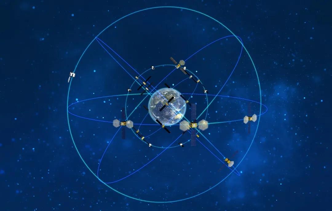
GEO satellite has an orbital height of about 36000km and an orbital inclination of 0 °,Relative geostationary,The coverage area of a single satellite is large, and three satellites can cover most of the Asia Pacific region.
IGSO
Inclined geosynchronous orbit

The orbital altitude of IGSO satellite is the same as that of GEO satellite, the orbital inclination is 55 degrees, and the trajectory of sub satellite point is 8 characters.
MEO
Mid circular earth orbit

MEO satellite has an orbital height of about 22000km and an orbital inclination of 55 degrees. It orbits the earth and can achieve global coverage through multiple satellite networks.
Beidou-3 global satellite navigation system consists of 24 medium circular earth orbits, 3 geostationary orbits and 3 inclined geosynchronous orbits, a total of 30 satellites, providing high-quality positioning, navigation and timing services for users all over the world.
After reading these abbreviations related to Beidou
Do you have a deeper understanding of Beidou?
What other acronyms do you know about Beidou?
What other information would you like to know about Beidou?
Welcome to share with us in the comments area
The content comes from the report of Beidou satellite navigation terminology and Beidou satellite navigation system construction and developmentEditor: Wu Zhongqi


Copyright © Shenzhen Kinghelm Electronics Co., Ltd. all rights reservedYue ICP Bei No. 17113853